How Florida’s Coastal Projects Benefit from BIM and 3D Visualisation
Florida’s coastline is beautiful, expensive, and brutally exposed.
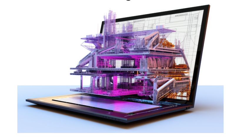
Rising seas, stronger hurricanes, saltwater intrusion, and constant erosion mean every seawall, marina, bridge, condo, and resort you build along the coast is operating on borrowed time if it is not designed with future risk inThat is exactly where BIM and 3D visualisation stop being “nice tech” and become non negotiable for serious coastal projects in Florida.
Below is a straight look at how Florida’s coastal projects benefit from BIM and 3D visualisation, not in theory but in day-to-day design, permitting, construction, and long-term resilience.

1. You are designing against moving water, not a static site
Florida is not just “near the ocean.” It is a high-risk coastal state where flood lines, storm surge zones, and access roads are constantly being re-evaluated.
For coastal projects, that means:
Today’s 100-year flood line will not be tomorrow’s.
A site that is “fine” at a certain elevation today may be underwater or cut off by flooded access roads in a few decades.
Insurers and investors increasingly want quantified climate risk and clear resilience measures, not vague assurances.
Using BIM and 3D visualisation in Florida coastal projects lets you overlay your design with flood scenarios, storm surge models, and sea-level projections so you are designing for where the water will be, not just where it is today.
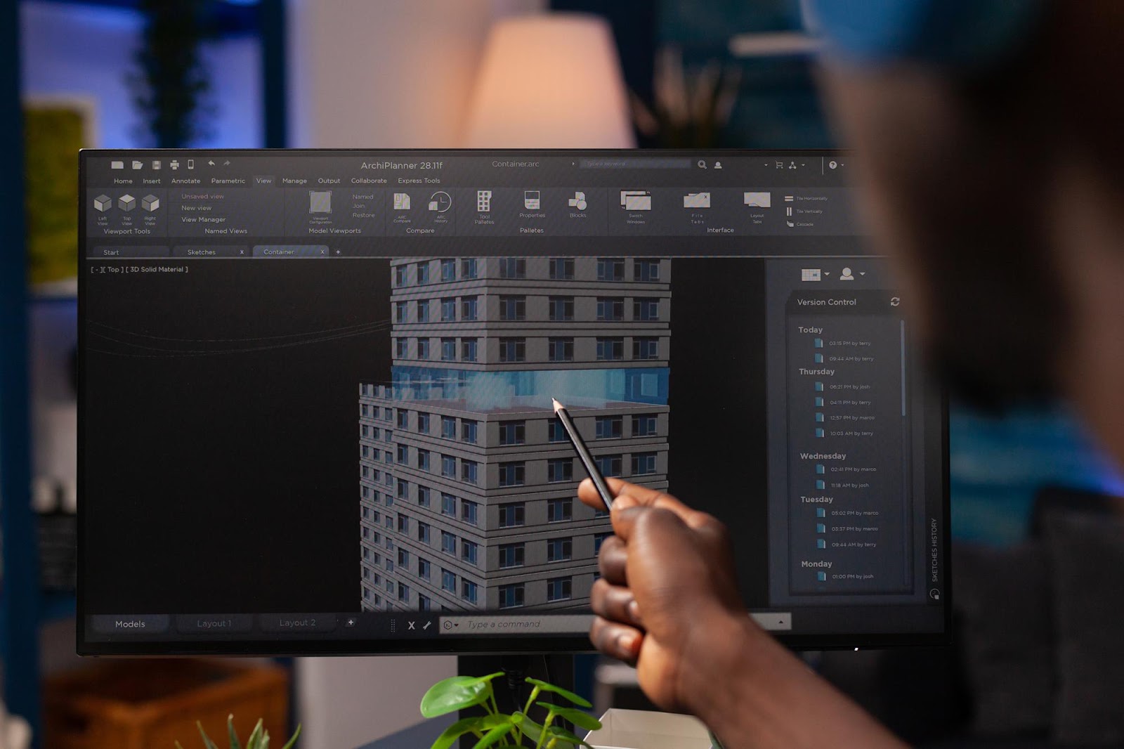
2. BIM turns coastal infrastructure into data-rich assets, not just geometry
Traditional 2D CAD gives you lines, layers, and a stack of PDFs.
BIM (Building Information Modeling) gives you:
3D geometry of seawalls, revetments, piers, pumps, dunes, buildings, and utilities
Embedded data: materials, reinforcement, elevations, corrosion protection, design life, maintenance schedules
Links to coastal, structural, and drainage models that predict performance under waves, storm surge, and sea level rise
For Florida’s coastal projects, that means you can:
Model different wall heights and crest elevations versus projected sea-level rise.
Attach design criteria like “meets 1 percent annual chance flood plus freeboard.”
Record inspection, maintenance, and replacement cycles directly inside the model.
The result: every pier, boardwalk, or pump station is not just drawn – it becomes queryable, updatable asset data that owners, municipalities, and O&M teams can rely on for decades.
3. 3D visualisation sells resilience to people who don’t read drawings
Most residents, councillors, and investors do not read technical drawings. They react to what they can see.
For coastal works, that matters a lot:
Residents want to see how high the seawall will look from their backyard or balcony.
Environmental groups want to see habitat features, not only sections and notes.
Councils want clear visuals when approving budgets and resilience funding.
By combining BIM and 3D visualisation for Florida coastal projects, you can:
Show side-by-side scenarios: today’s shoreline, projected future high tide, and proposed protection strategy.
Render living shorelines, hybrid seawalls, and eco-friendly revetments as realistic spaces, not abstract concepts.
Produce fly-throughs that walk stakeholders through evacuation routes, access roads, floodable ground floors, and raised MEP rooms.
Public support and permits get a lot easier when everyone can see both the risk and the solution in 3D.
4. Smarter seawalls, living shorelines, and marine structures
Florida is already experimenting with next-generation coastal systems such as living seawalls and modular panels shaped to support marine life while reducing wave energy.
BIM and 3D visualisation amplify this kind of work by allowing you to:
Model complex surface geometries for panels and revetments and verify constructability.
Run clash detection between piles, tie-backs, utilities, and dock structures before anything hits the water.
Create parametric variations of seawall modules depending on depth, environmental zone, and wave exposure.
Coordinate with marine biologists, landscape architects, and structural engineers inside a single shared model.
If you are designing next-generation seawalls, marinas, and coastal parks in Florida, BIM and 3D visualisation give you the control to push innovation without losing buildability.
5. Coastal buildings and MEP systems that do not fail on day one
The risk is not only the shoreline itself, but the buildings and MEP systems behind it.
In coastal Florida:
Wind loads, salt spray, and storm surge attack external MEP equipment and façade systems.
Flooded basements can knock out electrical switchgear, fire pumps, and chillers.
Poor routing decisions can put critical services exactly where floodwater will hit first.
Using BIM and 3D visualisation in Florida coastal projects lets you:
Place MEP equipment at realistic elevations and freeboard, and visually confirm no critical elements remain in flood zones.
Coordinate dry floodproofing measures, flood barriers, and raised platforms with door thresholds, ramps, and accessibility needs.
Test evacuation paths, refuge areas, and emergency lighting in 3D, instead of guessing from 2D plans.
For hospitals, data centers, resorts, and mixed-use towers along Florida’s coast, this is the difference between staying operational after a major storm and writing off tens of millions in damage.
6. Plugging resilience thinking straight into your BIM workflow
When you use BIM and 3D visualisation for Florida’s coastal projects, you can build resilience logic directly into your model:
Flood levels, wave heights, and design storms become parameters that drive elevations, freeboard, and protective features.
Asset risk profiles such as “at risk of access loss after a certain year” can be stored as data inside each bridge, road, and building.
Phased adaptation strategies, like raising seawalls or adding berms, can be visualised as future project stages in the same model.
Instead of treating climate resilience as a separate report, it becomes part of the digital twin of the project.
7. Hard business benefits for Florida’s coastal owners and agencies
This is not just climate talk. There are direct financial reasons Florida’s coastal projects benefit from BIM and 3D visualisation:
Fewer redesigns and RFIs
Early 3D coordination between coastal, structural, MEP, landscape, and marine disciplines means fewer onsite surprises and change orders.Higher approval and funding rates
Clear 3D visuals plus data-rich BIM models make it easier to win public support, resilience grants, and insurance negotiations because you can clearly demonstrate what risks you are mitigating.Better life-cycle performance
With BIM, you are not designing a one-off project. You are delivering an asset database that supports inspections, condition tracking, and future adaptation instead of full reconstruction.Stronger climate-risk story for investors and insurers
Being able to respond with BIM-based, scenario-tested designs is a competitive advantage when lenders and insurers are actively profiling sea-level and flooding risk.
8. What this means for your next Florida coastal project
If you are still pushing coastal projects in Florida with 2D CAD, fragmented spreadsheets, and a couple of static sections, you are gambling with both money and resilience.
To actually deliver coastal work that stands a chance in the coming decades, you need to:
Treat BIM as the backbone of every seawall, marina, coastal road, or oceanfront building.
Use 3D visualisation to align residents, agencies, and investors around the same reality.
Bake sea-level rise, storm surge, and flood scenarios directly into your design decisions.
Comments
Post a Comment